Disclaimer: The Physical Oceanography Research Group (PO-Res. Grp) makes every
effort to ensure that information contained in these pages is accurate and up to
date. However, the PO-Res. Grp accepts no liability and/or responsibility for the
reliance placed by the users of these pages on the information contained in these
pages or any other information accessed via this web page. The information provided
in these pages is provided on an "as is" basis and no warranties of any kind are
issued whether expressly or implied by the PO-Res. Grp on the information provided.
WP4 Services
The data provided by the networks set up in WP3 will be transformed into targeted,
added value services. The focal activities are:
A cross-border stakeholder Working Group intended to promote the exchange
between responsible entities for civil protection, surveillance and
security, especially with regards to response to hazards from oil spills
in the region.
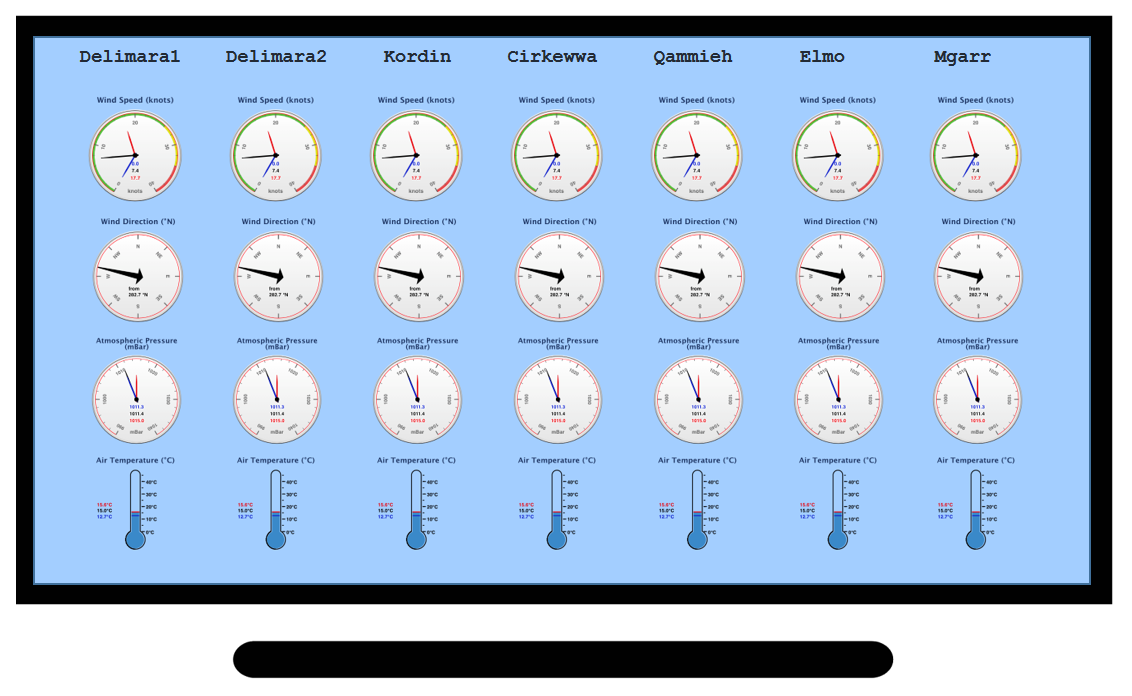
Real-time interface for PORTO meteo network
in Malta
An online interface providing an integrated access to data for professional
users and aggregated data services to public users. Besides enhancing the
coverage and functionality of
KAPTAN, a new smartphone application, called PORTO, will be
developed to be used primarily by ship and harbour masters for safer
navigation in proximity to ports. PORTO will aid port operators for
safer activities especially during entrance/exit of ships in/out of
harbours under adverse meteo-marine conditions, such as strong winds and
waves, and possibly seiches, in harbours where sea level measurements are
available. The smartphone app will primarily deal with data acquired by
the harbour monitoring system developed in WP3, as well as third party
data from satellite and numerical models.
Higher resolution numerical modelling forecasting services will cover the
Sicilian coast in more detail.
The existing oil spill detection and fate prediction system,
The Malta Shelf Oil Spill Tracker, is being upgraded
with an online oil spill bulletin generator covering a domain beyond the
Malta shelf area. Oil spill modelling trials will be made on higher
resolution models to enable simulations closer to the coast and within
embayments.
Search area predicted by SARWapp
The S&R web application (SARWapp) is being developed. The system will use
the SaaS paradigm, where all the model processing is carried out on a
server, while the user device is used as an interface for the user to
interact with the system. This approach facilitates the distribution of
this application to other Port Authorities on a national level or any
other entity. The system will ensure that all parties involved in the S&R,
both on land and at sea, have access to the same, up-to-date simulation
and search path results.
Simulations for training and the use of drones in tackling emergency
situations in ports or at sea will be conducted by CALYPSO South partners
and invited Sicilian stakeholders.
The use of different techniques to improve the quality of data provided
by the radar network is being assessed. Frequency interference in HF
radars is a known difficulty that leads to deterioration of data and
gaps in time and space. Work will continue on the use of Artificial
Neural Networks to develop an operational chain for the generation of
missing information. The system will execute in an ‘online’ mode with a
dedicated interface to include past and all future records as training
data. Furthermore, the Auto Regressive Moving Average (ARMA) Model will
be used in time for both data gap filling and short-term forecasting.
Validation will be done imposing virtual gaps and comparing simulated vs
actual values. During the validation phase different scenarios will be
considered in order to test reliability of ARMA predictions under several
sea current regimes and spatial/temporal patterns.